|
|
|
|||||||
| We no longer use activation emails. Please allow 24h after sign up and your account should work |
 |
|
|
Thread Tools | Display Modes |
|
#1
 29-08-2013, 09:24 AM
|
||||
|
||||
|
I've communicated with Dr. Eric Wade (Local Mining Engineer) and been given permission to publish his paper "The Broomhill / Amble Undersea Project". Anyone who has worked down a coal mine in the North East will be at least familiar with Dr. Wade's name from the inevitable "bait time" discussions of potential mining futures.
The particular copy of this paper I have (borrowed from Alan J, forum member) is missing a few illustrations which I hope to find and add at a later date. Original publication I believe is the early 1980's but will confirm this. The paper is now here: The Broomhill / Amble Undersea Project The post script to this is that an attempt was made to access these reserves from Ellington but was abandoned - just as they reached the area. 
|
|
#2
29-08-2013, 09:38 AM
|
|||
|
|||
|
Thanks to you, Coquet and Alan J for putting this on the site. It does look interesting, and certainly a publication date would help. I might even interest him indoors, who is a geologist by training.

|
|
#3
29-08-2013, 10:15 AM
|
||||
|
||||
|
You shouldn't have told me we have a geologist on tap!
From the paper's historical section it was Professor Herman Merivale that devised the safe working limit to the sea bed for undersea mine workings, and those distances still stand today. [The professor's sons went off to war in 1915 with the 7th battalion Northumberland Fusiliers you may recall - lived Togston Hall] I see from the paper a borehole was put down at the low water mark on the end of the Bondicarr rocks. That must have been a difficult spot for drilling - wonder how they achieved that?
|
|
#4
29-08-2013, 10:24 AM
|
||||
|
||||
|
I'm working on a sketch plan of the Hauxley Brockwell workings - again from Alan J's material. This was the end of deep mining
in Amble township when it finished with the Hauxley closure. It's quite interesting to look at. It covers this area: Hauxley point, out to the island, up to the piers, and inland crossing the road [oops subsidence!] between Amble and Moorhouse. 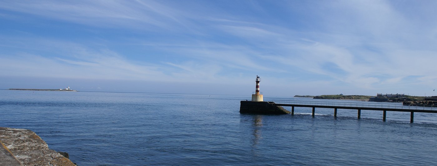
|
|
#5
29-08-2013, 11:08 AM
|
||||
|
||||
|
Regarding a date for the Undersea paper: he refers to the Whittle Shilbottle Complex - so I assume this means they are connected at this time - As a vagrant apprentice electrician I was in and out of the roadway drivage to connect the collieries - but when was that? 1980/81 I'm guessing. Now on the plan attached to the paper Ashington is still open which closed in 1988. So we should have a date within 1980-1988.
You can ignore Lynemouth on that plan - it's show as open because the shafts were open right up until the closure of Ellington. I stood at the bottom of Lynemouth shaft 2002, it was 'meshed off' out of bounds - but still had to squeeze in to have a look at an empty mine shaft from the bottom - most impressive looking up. [I should add it was open as an intake (fresh) air source for Ellington]
|
|
#6
29-08-2013, 11:55 AM
|
|||
|
|||
|
Quote:
Nice photograph by the way, looks to me like you were clinging on to the end of the North Pier ?
|
|
#7
29-08-2013, 12:17 PM
|
|||
|
|||
|
Quote:
|
|
#8
29-08-2013, 02:15 PM
|
||||
|
||||
|
yes there's that as well. Also the fact that the drive north from Ellington was well underway in 1988 - but there would be a long drawn out feasibility study between Dr Wade's paper and any new development from Ellington so it must be very early 1980's.
|
|
|
|


 Linear Mode

