|
|
|
|||||||
| We no longer use activation emails. Please allow 24h after sign up and your account should work |
 |
|
|
Thread Tools | Display Modes |
|
#41
 02-02-2016, 12:05 PM
|
|||
|
|||
|
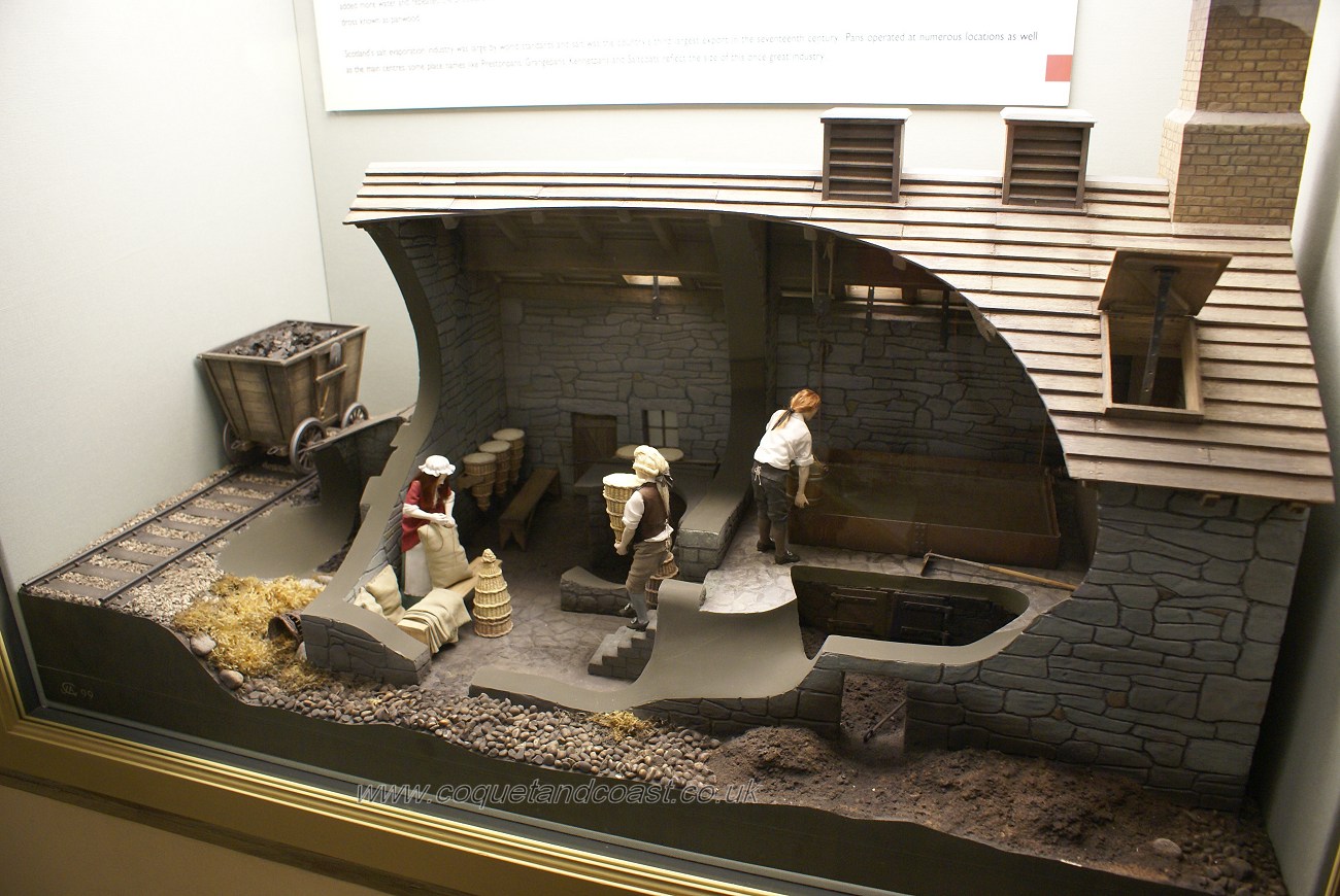
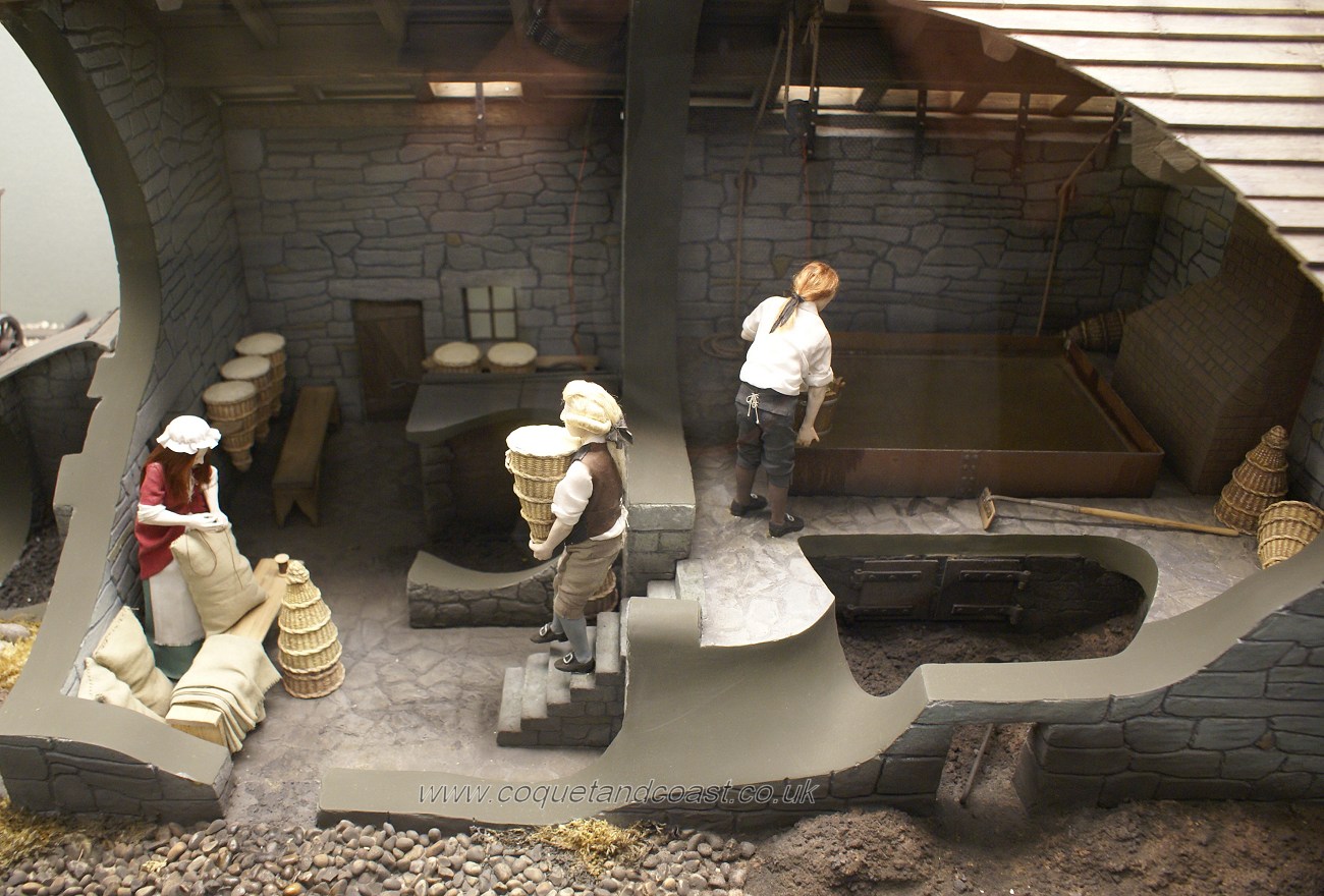
It's some time ago since there was a thread about coal mining at Amble and Wellhaugh but I came across this old newspaper article about it from 1783:
To be let for a term of years, and entered on immediately, or when agreed upon, all that colliery and seams of coal lying under the several estates in the Manor of Amble, in the parish of Warkworth, and county of Northumberland: And all those premises and other conveniences for making of salt, situated upon the sea rocks at Amble Point, which is allowed by all judges to be the most eligible situation upon the East Coast for making of salt, having at the ebbest tides a constant supply of salt water. - The Colliery will either be let to be wrought in any part of the Manor, and to the greatest extent, or otherwise in a part of the Manor convenient to the Salt Pans, and for the use of them only. Mr Robert Fawcus, of Amble Hope Houses, near Warkworth, will, upon application, show the premises. Whoever chooses to take the said Colliery, and premises for making of salt, are desired to send their proposals in writing, sealed, and addressed to Mr John Leadbitter, of Capheaton." Newcastle Chronicle, 6 December 1783 
|
|
#42
03-02-2016, 03:44 PM
|
||||
|
||||
|
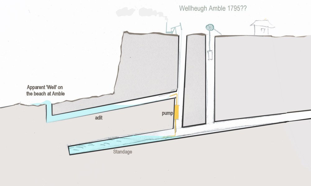
Interesting. On the subject of Wellhaugh/Wellheugh, I've been under the impression that it is called Wellhaugh because of the water well there. This appears on the rocks on the beach, below the high water mark? odd?
I'm wondering now where I got the information from that there was a water well at Welhaugh? Anyone seen this mentioned in the old texts anywhere?
|
|
#43
09-08-2016, 12:37 PM
|
|||
|
|||
|
Another interesting snippet about the mining going on during the 1910 miners strike from the Sunderland Daily Echo of 16 March 1910:
"COAL MINE ON THE SEA SHORE One of the novelties produced by the miners' strike in Northumberland is the open-air, low water colliery which has been opened on the beach at Amble. The coal outcrops there, and for some time a hundred men have been working regularly at low tide, and it is estimated that 500 tons of coal have already been taken out. Operations are carried out in the usual way, the shot firing being a continual source of interest to the many spectators who watch the work."
|
|
#44
09-09-2016, 04:55 PM
|
||||
|
||||
|
I see the proposed development at Signal cottage is causing a bit of a stir.
The Coal Authority thinks the area likely contains mine workings. https://publicaccess.northumberland....=OBC9UWQSJ5X00 (find the coal authority document) We've known this for years haven't we?  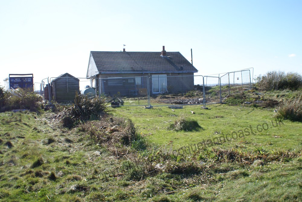
|
|
#46
09-09-2016, 05:21 PM
|
||||
|
||||
|
The well on the beach is a bit of a mystery to me. Daughter and I got a water sample some time back to analyse the salt content. Bottle still sitting on the shelf not done.
 Could be a simple man made circular hole in the sandstone around a natural spring. Or it could be something mining related?? A drainage adit seems unlikely due to the lack of land elevation, plus it is below the high water mark. 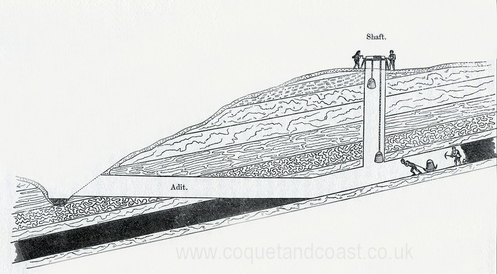 A variation of the above not impossible but I doubt it, it would require a pump to work at Wellhaugh.
|
|
#52
02-11-2017, 07:38 PM
|
||||
|
||||
|
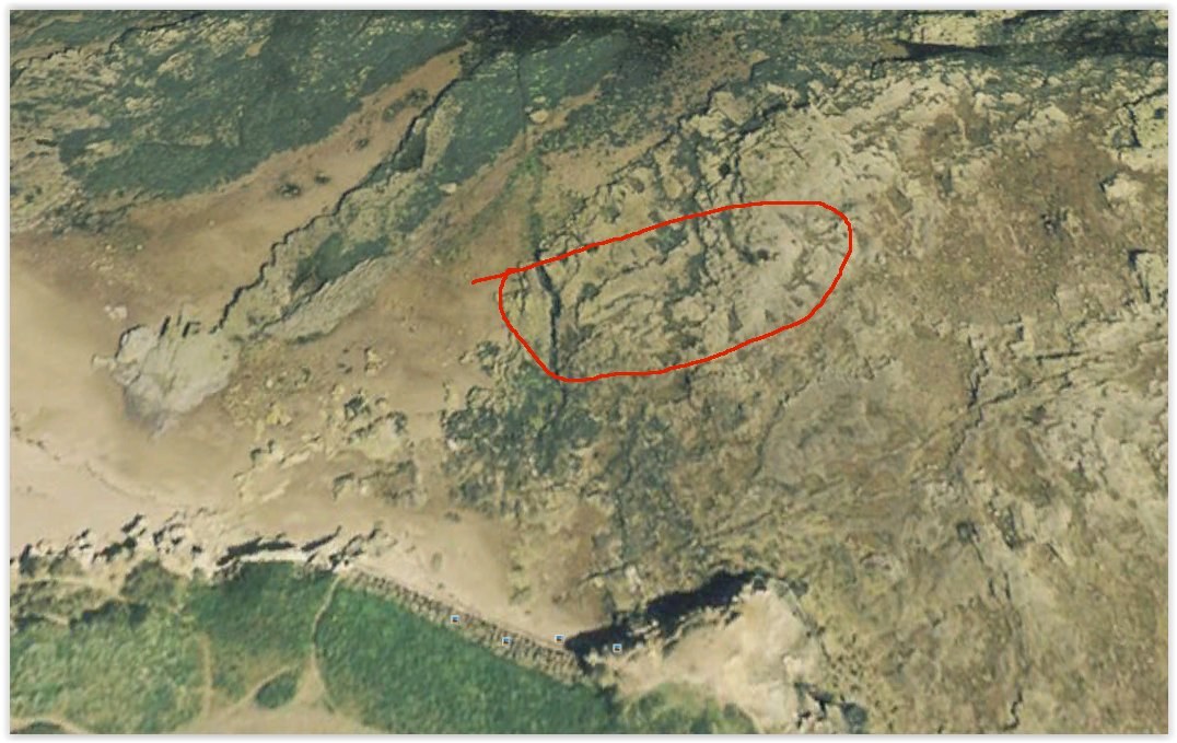
They are interesting. I have a vast number of photos of the local geology. Took a photo of those a few times? (sad??)
They are called 'rip up clasts'. If you imagine a layer of peat being scoured over by an erosive current full of sediment which rips up bits of peat (or coal) from below, which end up being incorporated into the overlying bed as the channels infill and settle out then you have it. So those bits of coal are from a seam below but have been 'ripped up' by later events. They are a geology classic, they occur in various contrasts, mudstone clasts in sandstone are common as well.
|
|
|
|


 Linear Mode

