|
|
|
|||||||
| We no longer use activation emails. Please allow 24h after sign up and your account should work |
 |
|
|
Thread Tools | Display Modes |
|
#3
 29-07-2013, 09:38 PM
|
||||
|
||||
|
Assuming the block of wood is a red herring?! It is an old sand pit for the local builders (J G Green being one), probably something to do with manufacturing the concrete blocks from ww11 that are still on the beaches?
Speaking of which, the line of blocks visible now were originally the second line on top of the dunes at Warkworth which were too awkward to remove after the war unlike the first line down on the beach. Erosion has done the rest. More clues please 
|
|
#7
30-07-2013, 12:25 PM
|
||||
|
||||
|
you can see it marked on this map, on the corner of Lady Newburgh's land.
http://communities.northumberland.gov.uk/009164FS.htm but the $64,000 question is how old is it? (I don't know)
|
|
#9
30-07-2013, 01:56 PM
|
|||
|
|||
|
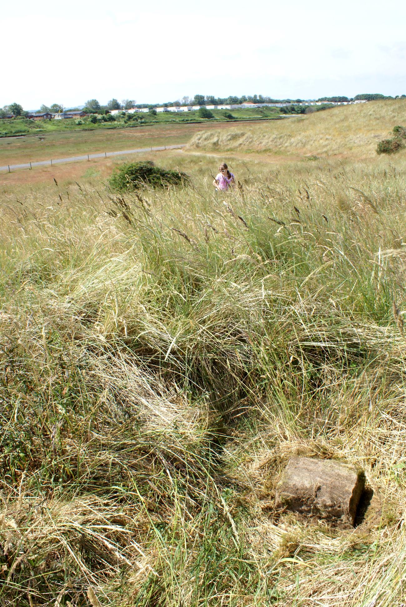
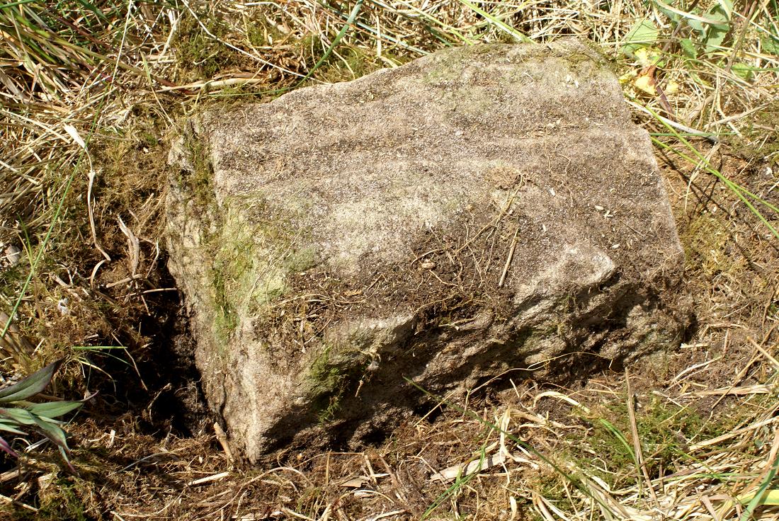
I think the marker is very old indeed! Had a look on www.pastscape.org.uk and did a location search. The number of the momument on that site is 7852.
It is recorded on a boundary survey as far back as 1563. "... from Spittell dyke downe Howmers to the Salter Bridge (Northum 35 SE), down the burne to the sea along the lowe water marke to Cokette Water and over the water to Beaken Hill where standeth a stone which is a march betwixte Ambelland Birlinge then westward up the Cokette to Helsay Cragge" (Greystone of Helsay name centred NU 25770546). (The stone still remains on Beakon Hill). The source for this information is Northum. County History 5, 1899, p 197 Field investigators comments from a 1954 survey read "At NU 25990564 and approx 120.0m north west of the hill is a stone demancating the boundary between Amble and Birling Parishes. It is an uninscribed rough dressed stone, square in section with 0.3m of its height above ground level. This is probably the standing stone referred to in the 1563 boundary survey" Sounds like the one in the picture!
|
|
#10
30-07-2013, 02:02 PM
|
|||
|
|||
|
Unbelievable.... you can read the original History of Northumberland County Volume 5 1899 online! It's been scanned at archive.org. Here is the link http://archive.org/stream/historyofn...e/196/mode/2up
You can even download the whole thing as a pdf if you want!
|
|
#11
30-07-2013, 02:58 PM
|
||||
|
||||
|
It is unbelievable, amazing that the dunes have not swallowed it up, great find though.
On Coquet's map the course of the Coquet in Amble is interesting, especially the railway, presumably on tressles to the north pier. The river was much narrower and shallower pre-drdging, especially at low water and much closer to the north side at the crossing point. Visions of a long bridge over the current river are wide of the mark when picturing what it must have looked like. A bit like the mouth of the Aln is now?
|
|
#12
30-07-2013, 10:03 PM
|
|||
|
|||
|
Lots of interesting things on the map. The other end of the railway appears to be on the rocks below where Cliff House would be built.
The course of the river goes into the little shore, up Ladbrook St. and along Newborough St. Runciman Way and Broomhill St. must have been built on reclaimed ground.
|
|
#13
31-07-2013, 07:13 PM
|
||||
|
||||
|
Quote:
Quote:
That's fascinating, the boundary stone would be the oldest object in the Amble township apart from the ruins behind High Street? (although Hollydog mentioned in another thread the ploughing patterns on or near the industrial estate land - those would also be earlier that 1563) Quote:
Quote:
I've noticed the rail track below high water in front of Cliff house - it seems bizarre but there must have been good reason for it.
|
|
#14
31-07-2013, 07:17 PM
|
||||
|
||||
|
I think the rest of the Amble township boundary stones are gone (opencast etc) - although there is another possible survivor on the east edge of Moorhouse farm.
Don't we have a member from Moorhouse - perhaps he/she could have a look?
|
|
#15
31-07-2013, 07:42 PM
|
|||
|
|||
|
I agree Coquet, I have spent far too long looking at old maps too!
However, sometimes it does pay off. I spotted those two (possibly three) stones at the end of Percy Drive. If you look at the map, it looks like the two to the South may be outside the water treatment plant. The northern most one looks like it may just be inside the plant fence. Hard to tell. Would be very interesting to see if any of them are still there.
|
|
#16
31-07-2013, 09:41 PM
|
|||
|
|||
|
Quote:
Last edited by janwhin; 31-07-2013 at 09:45 PM.
|
|
#17
31-07-2013, 11:48 PM
|
||||
|
||||
|
Quote:
They must have still worked the quarry from the land side but dropped the blocks over onto the tracks with cranes? Here are some blocks on the North Side, probably from that quarry. The top layer is Whinstone but the lower visible four layers are typical Amble sandstone. The Whinstone could be from Acklington (the Dyke) or there is another old quarry near Guyzance for this type of stone, or even the Craster area. These are big heavy blocks! I did measure them the day I took the photo, and worked out the weights from the density of Basalt (Whinstone) and Sandstone, but I've lost my notes on that, so "bloody heavy" will just have to do.  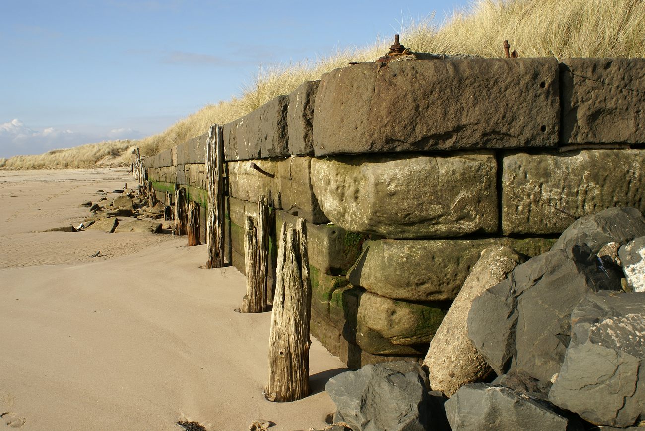
|
|
#18
31-07-2013, 11:58 PM
|
||||
|
||||
|
Quote:
here's that cluster of four on the 1950s map:
|
|
| Thread Tools | |
| Display Modes | |
|
|


 The old course of the Coquet but what is that lump of thingy....is it a timber


 Linear Mode

