|
|
|
|||||||
| We no longer use activation emails. Please allow 24h after sign up and your account should work |
 |
|
|
Thread Tools | Display Modes |
|
|
|
#1
 10-08-2015, 01:03 PM
|
||||
|
||||
|
Anyone got a map of the historic 'wards' for Northumberland?
We come across 'wards' regularly when do a bit of genealogy but who has the maps showing boundaries?? This is in an old (1877) book on the Northumberland Militia I'm having a look at, need a map to go with it  : :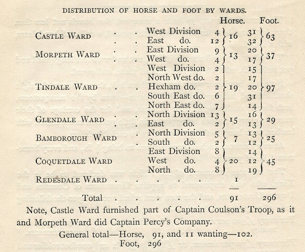

|
|
#4
10-08-2015, 01:49 PM
|
|||
|
|||
|
According to the "History of Parliament the House of Commons" the wards were Bamburgh, Castle, Ccoquetdale, Glendale, Morpeth and Tynedale. No mention of Redesdale.
There were also the detached Durham districts: Bedlingtonshire, Norhamshire and Islandshire. If I remember correctly, Mackenzie's History is broken down by ward. I haven't got my copy with me but it is a free ebook so I'll have a look.
|
|
|
|


 Hybrid Mode
