|
|
|
|||||||
| We no longer use activation emails. Please allow 24h after sign up and your account should work |
 |
|
|
Thread Tools | Display Modes |
|
|
|
#1
 25-02-2016, 05:29 PM
|
||||
|
||||
|
According to my Pevsners, Amble Golf Course contains a "Bronze age burial ground, comprising no less than forty graves. Revealed by accident 1857, badly excavated 1883." Can anyone throw any light on this? Indeed, is there still a golf course at Amble?
Pevsner also writes about a former manor house, name of Hillbank. He goes on: "Of the former manor house no more is visible than one wall with a c15 window (behind the R C Church, High Street)". Considering that Pevsner was writing in 1957 (possibly earlier), is this `wall` still in existence? Or has it given way (literally) to a supermarket or such like? Incidentally, Pevsner describes Amble as "A small town singularly devoid of architectural interest." But let us draw a veil over this. He says pretty much the same about Rothbury! Source: Nikolaus Pevsner `The Buildings Of England, Northumberland` 1957, Penguin Books. PS. Apologies: this was meant for the board `Amble and Hauxley ` below. Last edited by Vagabond; 25-02-2016 at 08:39 PM. 
|
|
#2
26-02-2016, 10:42 AM
|
||||
|
||||
|
Hi Vagabond, The big bunch of graves was near the building now called
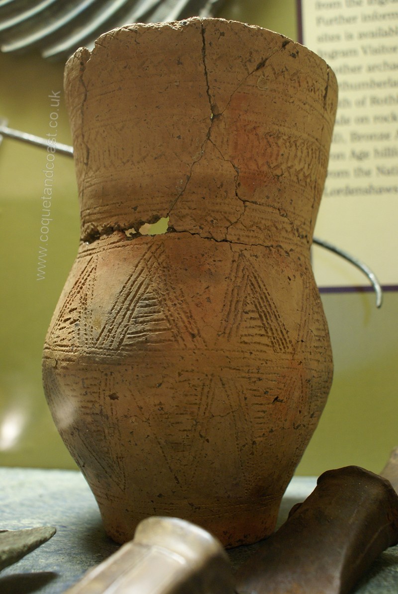
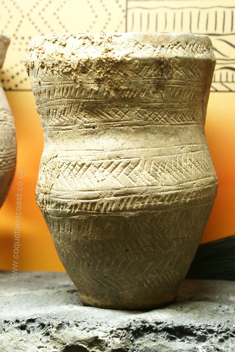
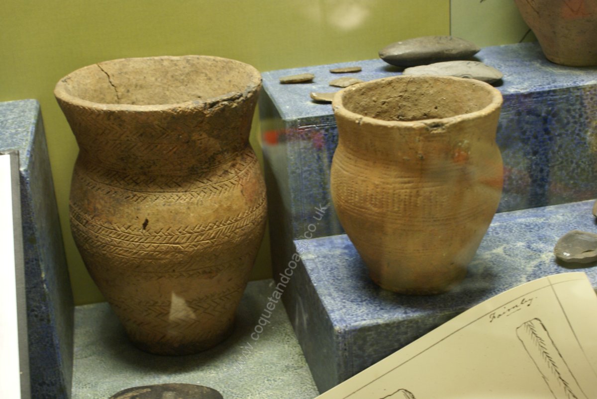
The first page of Hodgson's history gives the detail: (I think Pevsner has confused the 1857 and 1883 discoveries as the same location, they are not) But it was in 1883 that the quarry (which is situated half a mile south of the spot where the cist was found in 1857) yielded prolific results ; they have been described in papers read before the Society of Antiquaries of London by the Rev. William Greenwell : It consisted of a cairn, made of cobble stones from the neighbouring sea-beach, placed upon a thin layer of vegetable mould with clayey soil beneath, overlying the rock. The cairn had been about 40 feet in diameter and 5 feet high. It was situated on the low bank there bounding the sea-beach, about 70 yards from its edge, and was entirely concealed under a deposit of blown sand, 9 feet thick, and therefore rising 4 feet above the top of the cairn. Though when discovered it was but a short distance from the sea, it is evident that when first erected it must have been much further distant, so far indeed as to be beyond the limit of sand blown from the beach. That this must have been the case appears to be proved by the fact that, whereas when discovered the cairn was buried like the adjoining ground under many feet of sand, it had been, when first thrown up, placed upon the ordinary surface mould which had no sand upon it, and, therefore, must have been beyond the range to which sand blown from the seashore extended. It had contained, so far as I could ascertain, about twenty cists of the usual kind and several deposits of burnt bones, an unusually large number of interments in one sepulchral mound. There were also seven vessels of pottery, one of which I found myself. more detail on that one on the Hodgson's page for Amble I expect the cairn was similar to the Bondicar one shown in this thread:http://www.coquetandcoast.co.uk/ambl...read.php?t=255 the quarry is shown on this map: 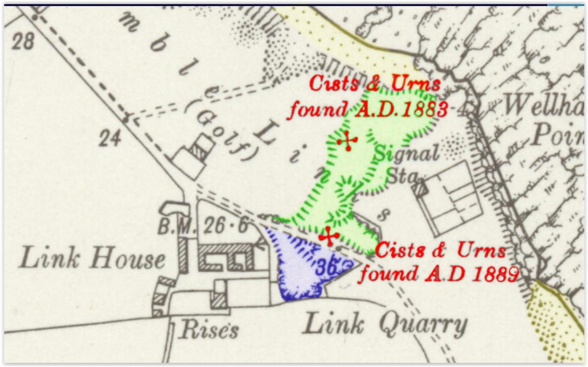 same area on google maps
|
|
#3
26-02-2016, 10:52 AM
|
||||
|
||||
|
I should say the Bondicar cairn is chopped in half by sea erosion.
Now the Quarry. It was soon after filled with household waste from Amble. The sea used to erode a wall of ash on the eastward edge and produced may old bottles. I found a beautiful amber 'Warner's Safe Cure' there one day, courtesy of a spring tide! (sadly now sold so I can't show you it) The blue seacton I've shown on the map was also filled with household waste, but more recent, probably from between the wars in my guesstimation. They were doing some earthworks in there at one time and again loads of old bottle produced but with screw caps and the like - which you will know are more recent.
|
|
#4
26-02-2016, 10:58 AM
|
||||
|
||||
|
|
|
#6
26-02-2016, 11:17 PM
|
||||
|
||||
|
On the subject of the 'beaker people' in Northumberland here's some'beakers' from Northumberland in possession of the Duke, could be Amble, not labelled. Forget your Clarice Cliff, this is the stuff to have on the mantelpiece. (just joking)
 : :  
|
|
|
|


 Hybrid Mode
