Quote:
Originally Posted by hollydog

I'm looking at the field boundaries, there are some very similar - straight across on Helsay Point looks good and the outline of the eroded Helsay Point is on the photo. Is it possible to superimpose the maps and google earth?
Thistly Hill possibly went when the river was straightened and deepened for the harbour C19th ? There is evidence of this directly opposite the Braid boat clubs with the wooden shoring holding back the mud flats thus speeding the river up
|
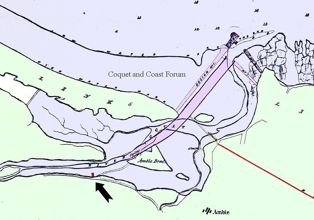
Remember this 1838 map? We will have to get out with the camera and photograph these wood structures. I was convinced that the remains of the staiths on the braid on this map are still there but now sit on the other side of the river to the projected path shown.
The Braid is the remains of the 'Salt Goats' on the 1610 map?
and another island? that one is probably closer to the weir?