Thread
:
Mystery History Photo.
View Single Post
#
31
13-10-2013, 11:27 AM
Coquet
Administrator
Join Date: Feb 2010
Location: Amble
Posts: 3,253
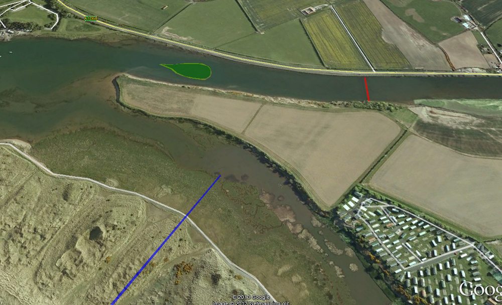
Looking on google maps I think now the Island was further down stream:
blue = boundary, red= modern weir, green = ye olde island.
image copyright Google 2013
Coquet
View Public Profile
Send a private message to Coquet
Find all posts by Coquet