There are old river banks/beds visible in the field to the immediate north of Gloster Hill but I think they are ancient.
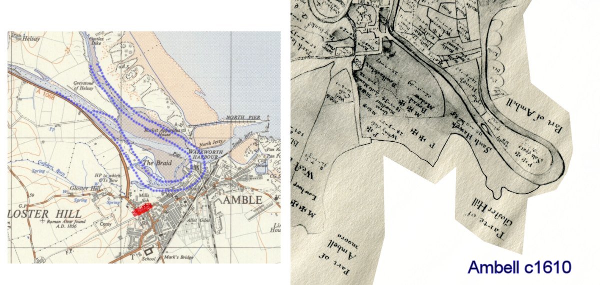
Below is the 'Ambell' c1610 map rotated around to match the modern map with the river loop occupying the Gut area. That is the area where I have always assumed the ships came to from the old descriptions.
Now the paved road goes from Amble - old Amble that is; top of the Wynd - Hallbank well area, to the river.
Sounds like a substantial road for carts, not just for the toll collector - I would not be surprised if it's an old coal road to the river - Amble's Medieval or Tudor coal road anyone? it was under a foot of dirt in the 1820s. Remember they wanted to develop a port in Elizabethan times, so there must have been a healthy coal industry already.