Quote:
Originally Posted by Coquet

I see what you mean now Phil, the pipe shown here passing out the back wall. I think it's just an open end behind there.
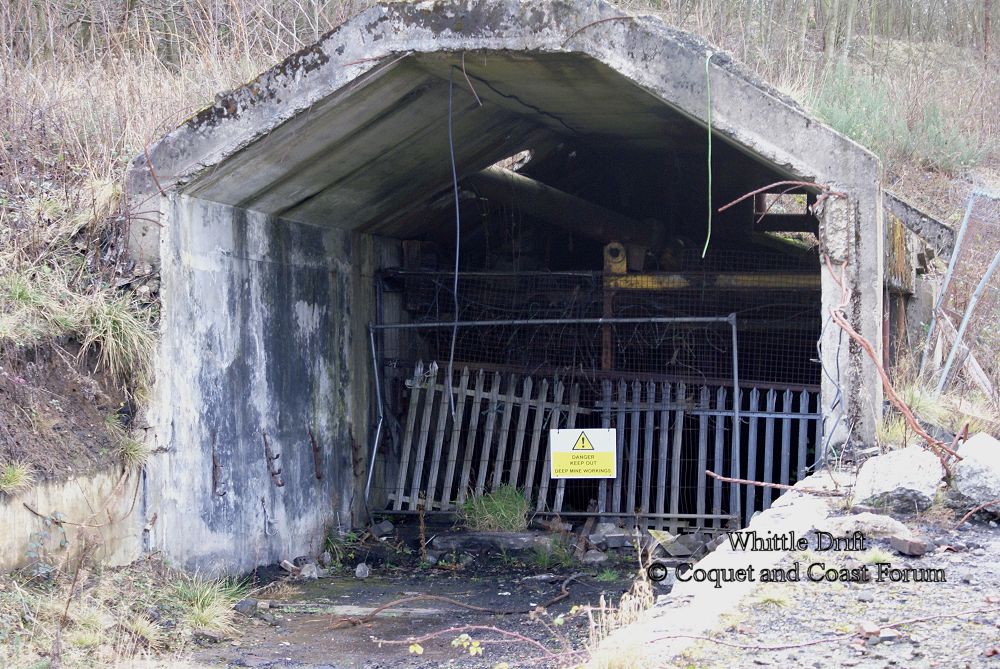 |
Not having a clue about mining I'm guessing the below photos aren't related to the above photo in anyway? According to the
sign, this is Whittle Drift Pumping Station, but it's a fair distance from where I assume most of the works and entrance were (down the hill to the north-west, among the sea of concrete?).
Click the images for the full-size versions.


The above is
here, up the hill a little alongside the railway as it heads off towards Hazon. It's impossible to get a good photo as it's all fenced off and largely surrounded by shrubbery.
If the drift entrance Coquet posted is further down among the concrete then I don't think it's there any more. Obviously I don't know where it was, but there's very little of anything to be seen now; a
few holes covered (second one about
here I guess, or the hole next to it?), what is perhaps an old
water bottle or something,
some hoses, a
transformer building, three or so shipping containers and dumped in the middle of the yard is what I
think are the things used to
suspend electrical wires above poles (
these things)? The
tracks for the wagons are largely still in place, though overgrown in places.
On a related note, any guesses what this, located
here, is for? It's near the treatment plant further along the rail line. It almost looks like something show jumpers would use, as it looks a lot like grit or sand, it looks bone dry, completely flat and entirely surrounded by a low stone wall. It's obviously related to the water treatment station, but I've no idea what it's for.

Most of Whittle seems to have a good few few public footpaths now (no idea if it was always like this?). I assume the main entrance is still locked, but there's a public bridleway from High Hazon (or Whittle Farm if you prefer a longer route) to Newton on the Moor, of which 90% is fine and the last 10% is meadow, thistles and ankle-twisting ground and a pain to get through (it's definitely a public bridleway though); as a result I walked back along the old railway line - there was a Coal Authority guy parked along there and he said it was a public footpath, but looking on Google
Streetview afterwards suggests it's private (though there are no signs on the gate now) so who knows. I wasn't going back through that meadow again, that's for sure!