Quote:
Originally Posted by Coquet

Looking on google maps I think now the Island was further down stream:
blue = boundary, red= modern weir, green = ye olde island.
image copyright Google 2013
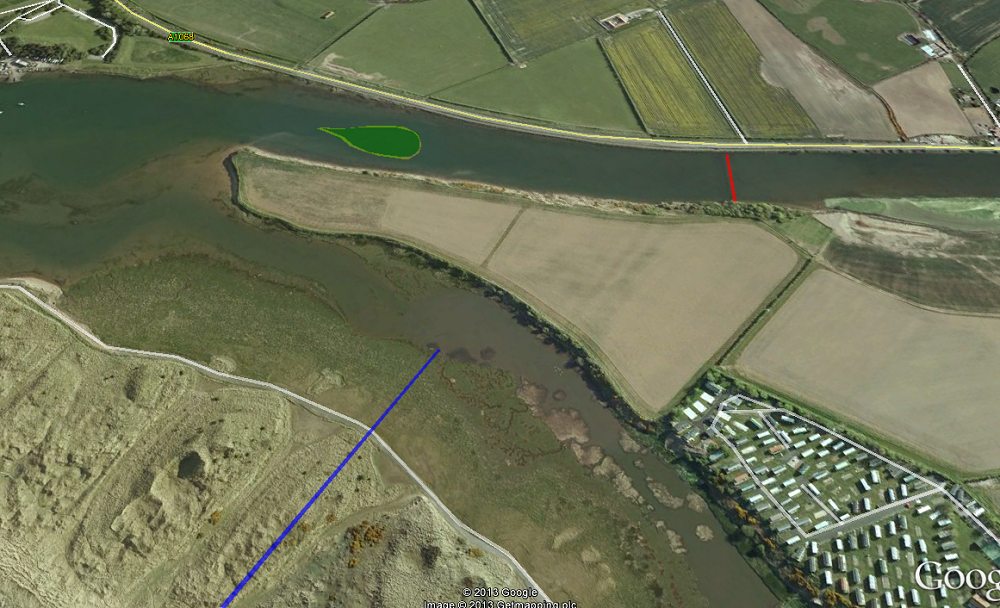 |
Coquet - can you confirm the site of the boundary stone along your blue line, its just that your opening photo lines up with the next hill north? or maybe down to perspectives!