|
|
|
|||||||
| We no longer use activation emails. Please allow 24h after sign up and your account should work |
 |
|
|
Thread Tools | Display Modes |
|
#1
 19-07-2016, 08:57 AM
|
||||
|
||||
|
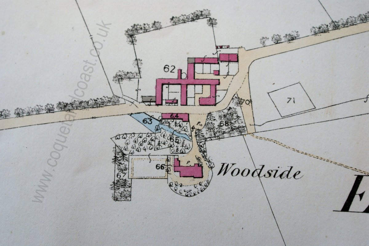
A few weeks back I took a few photographs of some of the 25 inch maps of the area (south) to add to the map page eventually. In two minds about doing this as we now know the Library of Scotland will eventually have the lot on their website.
Cleaning up the images takes an age, but you can produce some nice maps from scruffy photos. Anyway, here's one for South Broomhill 1923 before and after: 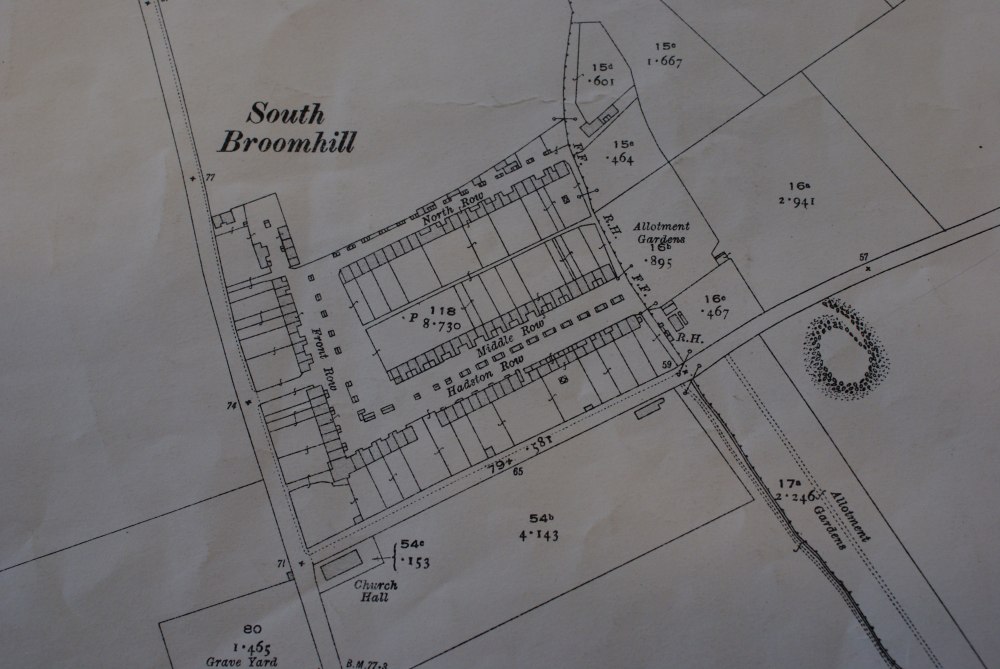 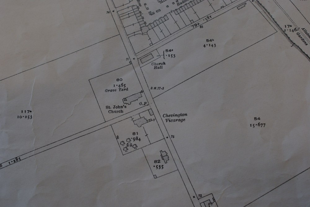 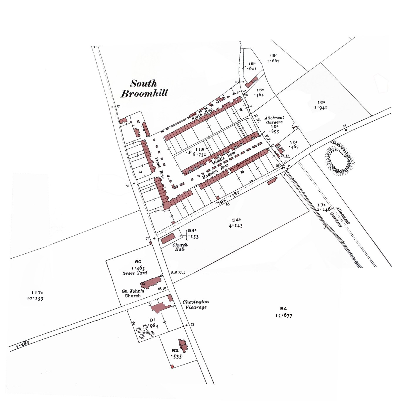

|
|
#11
19-07-2016, 02:58 PM
|
|||
|
|||
|
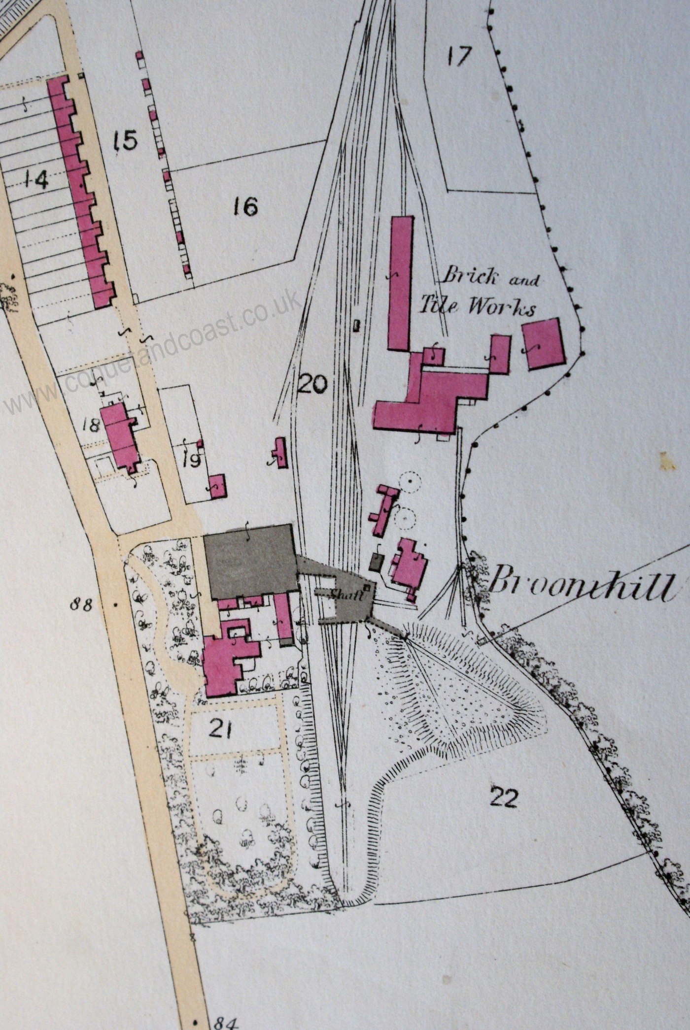
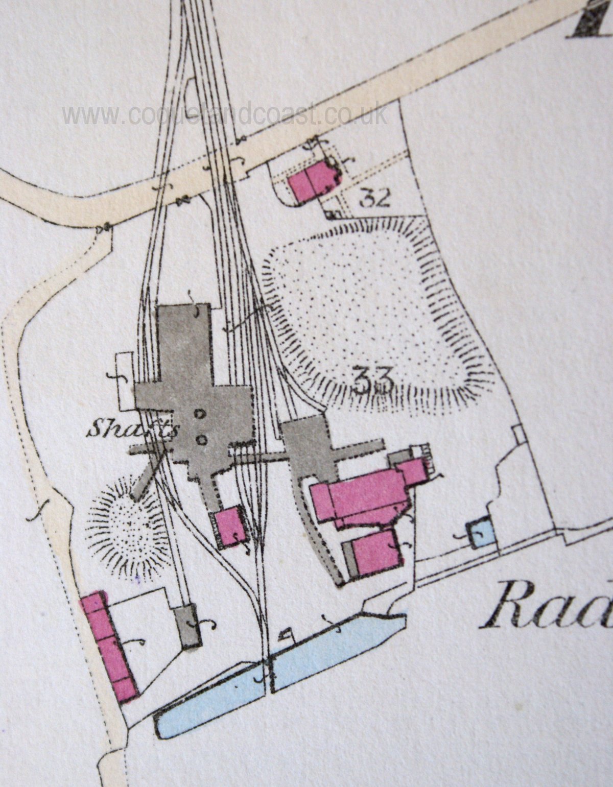
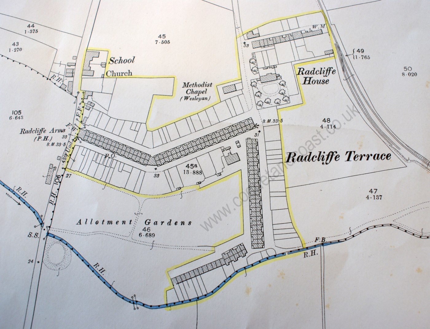
Nice maps, pleased you put them on, National Library notwithstanding.
On the S Broomhill Map there is something in the school grounds, looks a bit like a spoil heap? Could that be one of the Broomhill drift entrances do you think? Sorry, I'm getting a bit obsessed by spoil heaps these days, a bit like someone's coal fetish 
|
|
#12
19-07-2016, 03:16 PM
|
||||
|
||||
|
There definitely was something there Janwhin - a drift I believe. I expected to see it on that 1923 map. We have it marked on something we have seen, I'm sure it was in (what became) the school playing field. I'll have a hunt around the digitised maps for it tonight.
|
|
#13
19-07-2016, 03:42 PM
|
||||
|
||||
|
Quote:
Taking the daughter on an expedition in the next few weeks to the only outcrop of the Shilbottle seam were the coal is still visible. She is so excited about that. ")
|
|
#17
20-07-2016, 10:56 AM
|
||||
|
||||
|
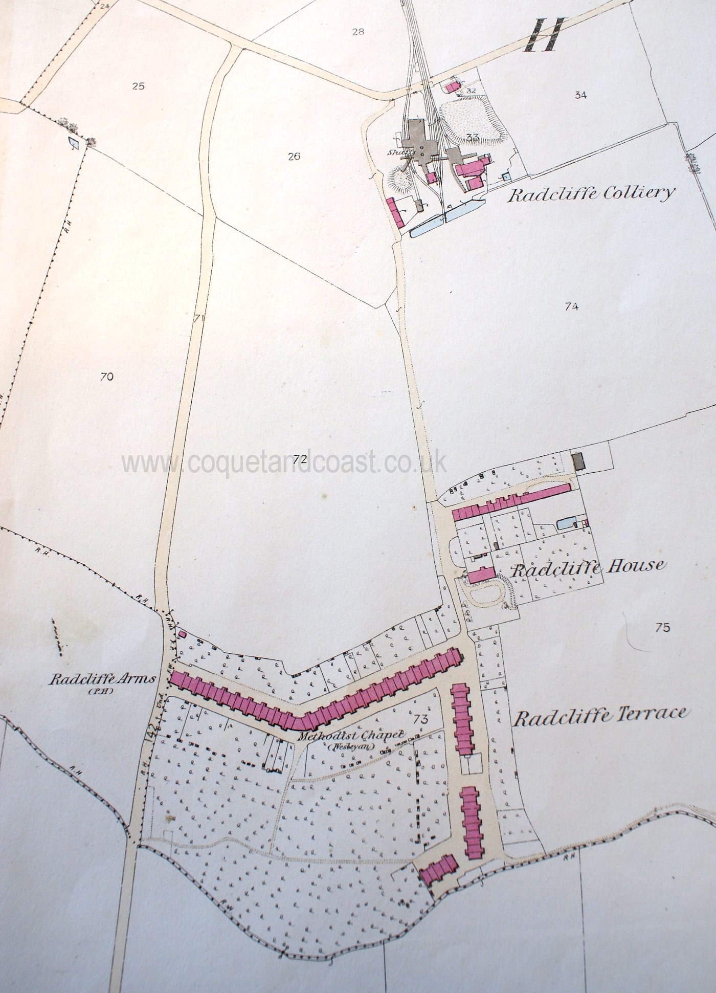
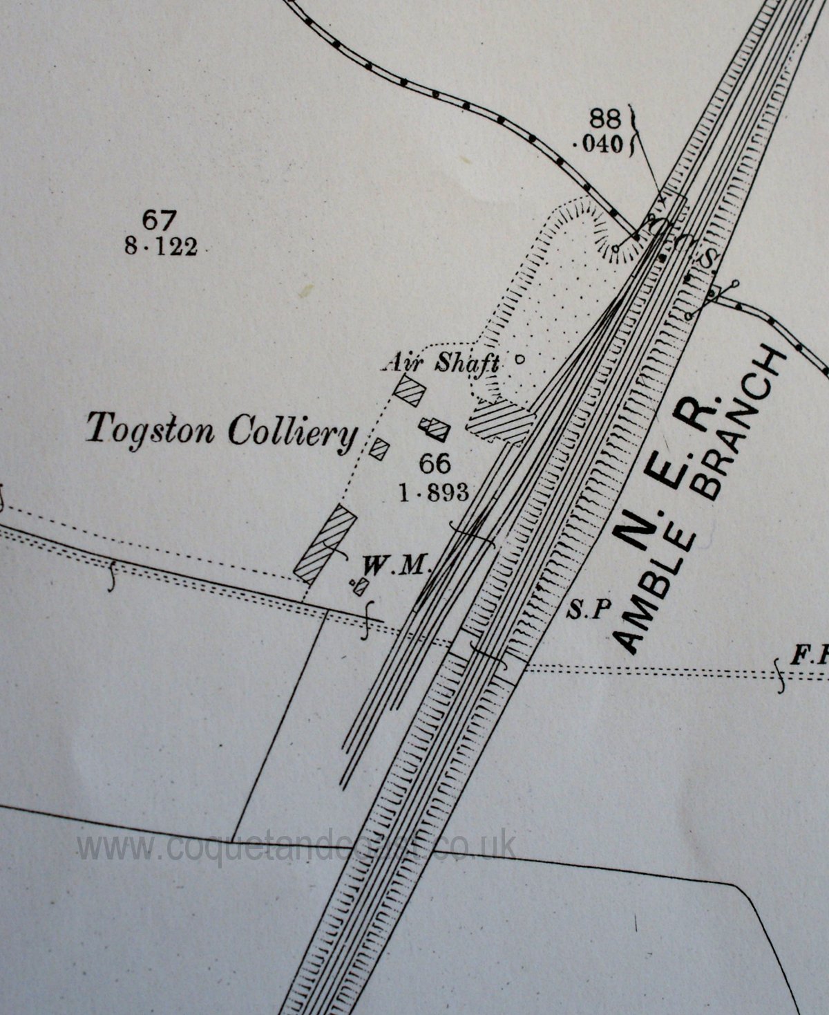
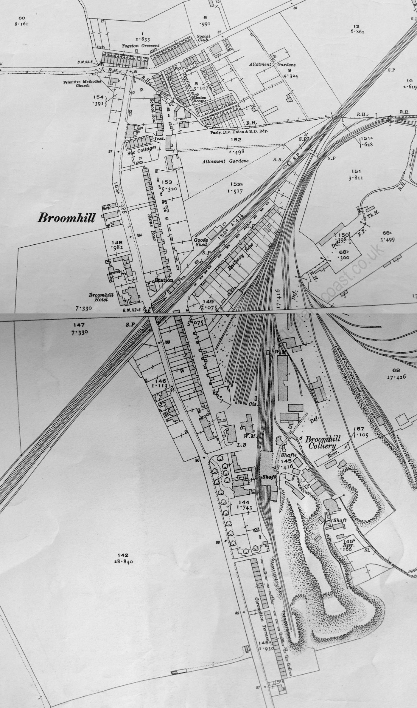
Togston Colliery 1866:
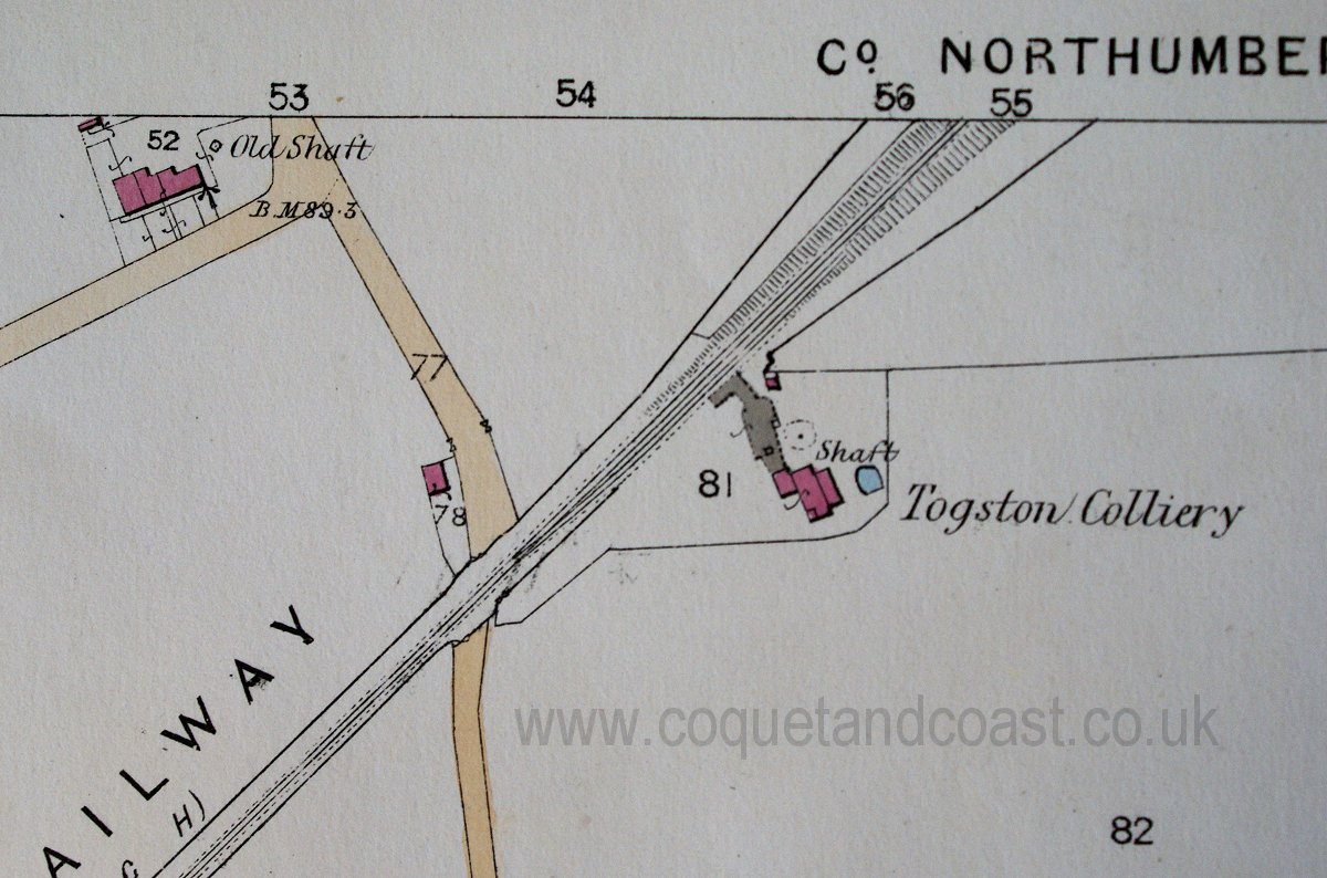 You can see the relationship of the above two here: http://www.coquetandcoast.co.uk/ambl...31&postcount=2
|
|
#20
20-07-2016, 01:32 PM
|
||||
|
||||
|
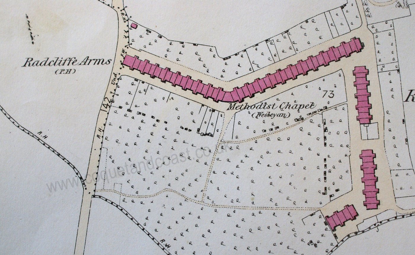
Togston Barns with an 'air shaft / engine house' to the south. Something new that I think, too far north to be Dawson's Drift, and they are calling it a shaft anyway.
I've lost my data on this one 1897 or 1923  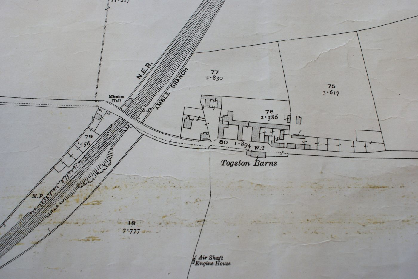
|
|
|
|


 Linear Mode

