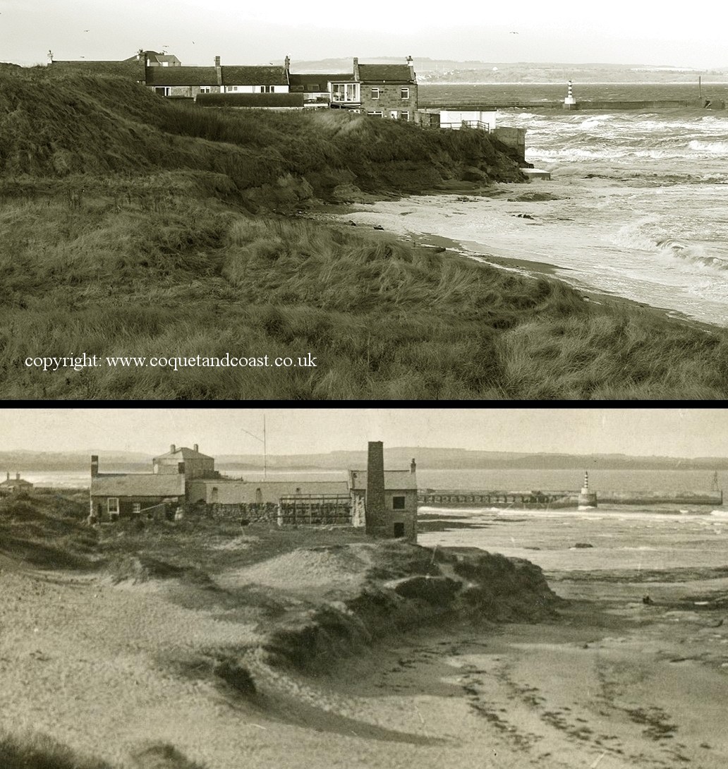
100 Years of erosion.
There's quite a range of erosion rates predicted for Amble Hauxley and Druridge bay. How accurate they will be only time will tell. I stuck these two images together - after standing in the approx same spot as the original photographer. It looks a different angle but that's an illusion caused by a first floor being added to most of the salt pans buildings and a waste tip has created an artificial hill in the mid-ground.
Anyway, you can see erosion has occurred to the sandstone and shale banks at the high water mark near the salt pans. Several metres I would say. This is potentially interesting for estimating a minimum age for any mine shafts/ bell pits that now appear below the high water mark.